Categories
Stories

Digital surface model of Jäkälämutka, Oulanka river

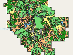
Oulanka river has been studied since 1974 by Oulanka research station and Oulu university “This is a unique, long time series of meander migration available”, says the dataset creator Linnea Blåfield. The dataset can be used for analyzing how the river environment is modified by the river flow. “When we understand how these flow and […]

Categories
Stories

Development ideas of Turku residents concerning the city block of Aninkainen Concert Hall

The data gathering of development preferences for the Aninkainen Concert Hall is a good example of coinciding interests among researchers, software developers and the city authorities in Turku, Finland. The data was collected through a map-based survey, which utilizes a 3D city model of Turku as the mapping background. The 3D offered the respondents a […]

Categories
Stories

The Geography of Glacial Meltwater

What are murtoos? The entirety of glacial fields all over the world are covered in subglacial meltwater routes. These routes create vast networks across icefields such as Fennoscandian Ice Sheet. In the Finnish region of the Fennoscandian Ice Sheet different subglacial landforms were studied to understand how many routes there are and how far they […]

Categories
Stories

Spatio-temporal analysis of heating and cooling degree-days over Iran

Fighting climate change is hard enough in Finnish conditions but fighting climate change in a country like Iran with limited academic resources and in an unstable political climate is something different. That is the case of Amin Sadeqi, an Iranian geographer and climate researcher, who has been succeeding in the field of climate change impacts […]

Categories
Stories

Stone age clay artefacts

What is this data about? You have found your way to a new but also historical dataset. The clay artefacts this data presents date all the way back to the prehistoric time of Stone age. This data puts on a map the places where archaeological clay artifacts have been found all around Finland and Karelia. […]

Categories
Stories

Cumulated Heat Sum in The City Region of Turku, Summer 2002

Would it be nice to know the hottest or coolest place in Turku? Would you like to choose the best sand beach or to escape the most awkward heat wave to a park? Seriously, heat stress strikes in a worst manner to diseased and elderly people, and it is reality also in Finland. In an […]

Categories
Stories

Geographical persistence of surface-layer water properties in the Archipelago Sea, SW Finland

Q&A with Harri Tolvanen Harri Tolvanen is an Adjunct Professor and a Geography University Lecturer at the University of Turku. His specialities are coastal geography, especially the archipelago of South West Finland. Currently Tolvanen is working on a project about human history of Uralic language speaking areas. We worked with a data set gathered by […]

Categories
Stories

Salinity and Turbidity of Halikonlahti

Personal Profile Jouni Salmela has always been interested in the natural world and the phenomena which occur in them. During his bachelor studies he was interested in a wide variety of subjects, however, during his master course he focused on fluvial geomorphology spending two years working on related research involving group work. Motivated by the […]

Categories
Stories

Associations between local land use/land cover and place-based landscape service patterns in rural Tanzania

We are excited to share new land use data from Tanzania that have been used to prevent misuse of natural resources. This unique data has developed with a new geospatial mapping method for local level land use planning in Tanzania. Land use data has a significant impact for the community by their involvement in the […]

Categories
Stories

Temperature observations from Turku in August 2006 and 2007

We are glad to announce that part of the TURCLIM data is now available in Excel format. The data consist of the TURCLIM observation points, and their x- and y-coordinates. TURCLIM data include the average temperatures of the observation points that have been measured in August 2006 and 2007. For example land use and elevation […]