
What are murtoos?
The entirety of glacial fields all over the world are covered in subglacial meltwater routes. These routes create vast networks across icefields such as Fennoscandian Ice Sheet. In the Finnish region of the Fennoscandian Ice Sheet different subglacial landforms were studied to understand how many routes there are and how far they expand. Previously subglacial meltwater routes were understood through distributed (inefficient) drainage systems and channelized (efficient) drainage systems. But recently a third hydrological network component has been discovered; murtoos. These new subglacial landforms are known as the missing link between distributed and channelized drainage systems.
Where do murtoos come from?
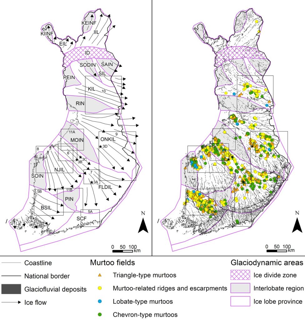
Murtoos are found mainly in the ice lobes region of glaciodynamic areas near drumlin fields or glacial lineation sets but where do they originate? The origin of murtoos are theorized to take place in ice beds warmed by the last deglaciation period where the pressure is close to zero and has intermediate ice-flow rates.
The shapes of murtoos.
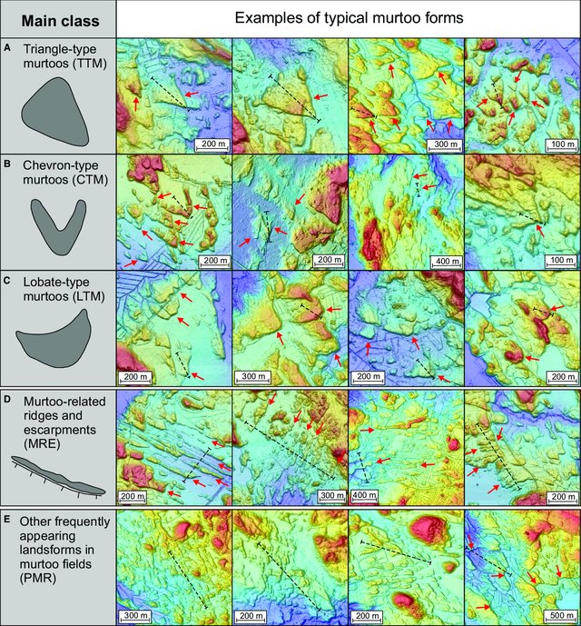
Murtoos often come in different shapes, sizes, and lengths. They can be sorted into five main shape types for triangle type murtoos, Chevron type murtoos, lobate type murtoos, murtoo Related ridges and escarpments, and other murtoo related polymorphous landforms. Murtoos typically take on a triangular appearance though and range from 30 to 200m with less than 5m of relief.
How are they researched and studied?
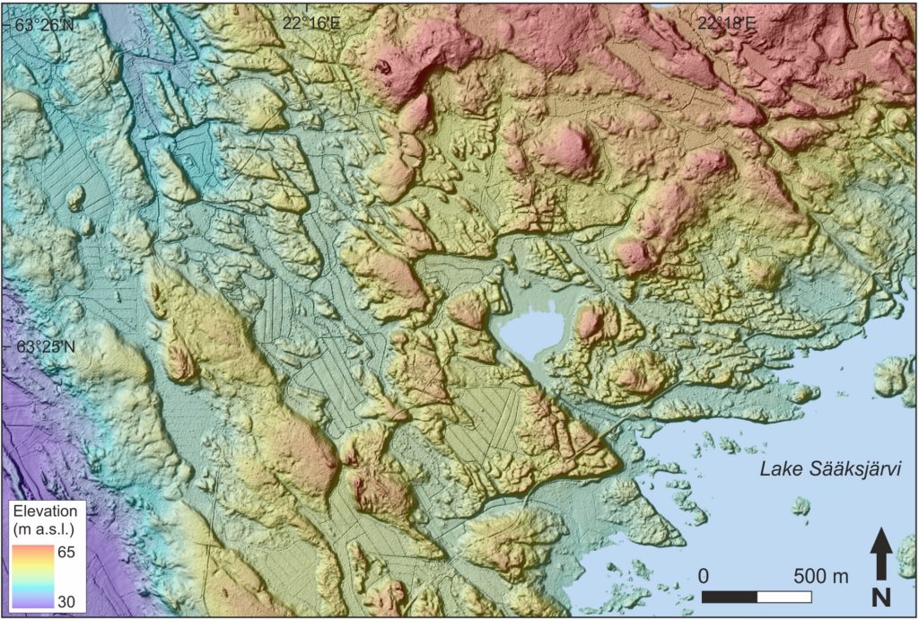
The ideal method for mapping the subglacial meltwater routes is using high resolution LiDAR DEMs such as the image above, which are provided by the National Land Survey of Finland. The Geological Survey of Finland has processed a precise elevation model (DEM 2m) from the LiDAR dataset, from which the hillshade is obtained. The hillshade is made especially for glacier-born soil formations and their examinations and mapping, and it has been used by the research team.
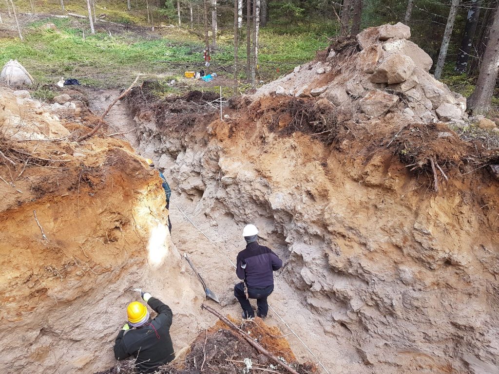
Routes were visualized and digitized in ArcMap with polylines and murtoofields were digitized with polygons.
How can this data be used?
The knowledge of murtoos can expand the understanding of new glacial meltwater routes across glacial fields and ice sheets. For understanding the melting of glaciers today, knowing the hydrology and subglacial meltwater networks of the ancient glaciers is important. And for that, murtoos are now a new key element.
Examining murtoos revealed 2689 new subglacial routes on the Fennoscandian Ice Sheet (Ahokangas, et al. 2021) many of which were murtoo routes. These murtoo routes on the ice sheet typically occurred along the margins of major drumlin fields or glacial lineation sets and often cut across ribbed moraine fields. Moreover, murtoo routes are substantially concentrated within the FLDIL ice-stream tract, which also has the densest occurrence of drumlin fields throughout the paleo ice-stream bed.
For more information:
REWARD-project (https://sites.utu.fi/reward/)
Ahokangas, E., Ojala, A. E. K., Tuunainen, A., Valkama, M., Palmu, J-P., Kajuutti, K. & Mäkinen, J. (2021). The distribution of glacial meltwater routes and associated murtoo fields in Finland. Geomorphology 389, 107854. (https://doi.org/10.1016/j.geomorph.2021.107854)
Ojala, Antti & Mäkinen, Joni & Ahokangas, Elina & Kajuutti, Kari & Valkama, Markus & Tuunainen, Aleksi & Palmu, Jukka-Pekka. (2021). Diversity of murtoos and murtoo-related subglacial landforms in the Finnish area of the Fennoscandian Ice Sheet. Boreas. 50. 10.1111/bor.12526.