Q&A with Harri Tolvanen
Harri Tolvanen is an Adjunct Professor and a Geography University Lecturer at the University of Turku. His specialities are coastal geography, especially the archipelago of South West Finland. Currently Tolvanen is working on a project about human history of Uralic language speaking areas.
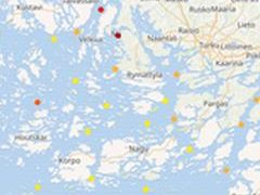
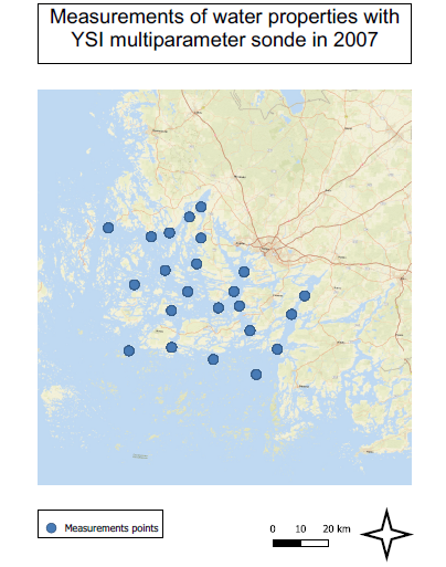
We worked with a data set gathered by Tapio Suominen, Harri Tolvanen and Risto Kalliola. It considers measurements of water properties with YSI multiparameter sonde in 2007. The data are based on the seasonal development of five surface-layer water variables (temperature, salinity, Secchi depth, chlorophyll and acidity) and the persistence of their geographical patterns at the Archipelago Sea.
There is an assumption that the spatial distribution of water quality properties during a particular calendar week reflects the overall spatial water quality pattern of that region (Suominen, Tolvanen & Kalliola 2010). The simultaneous sampling of non-simultaneous phenomena results in biased results, but these sampling designs are widely used because more frequent sampling would be impractical to use.
The results of the study mostly support the previous known geographical patterns of seawater properties and dynamics (Suominen, Tolvanen & Kalliola 2010).
We met with Tolvanen in October 2021 and asked him few questions about this data set, his other work, and thoughts about open data.
Q1. Are you currently working on any new projects? If so, are they linked to this one?
A. I am working on project about human history of Uralic language speaking areas. This project isn’t linked to the previous one.

Q2. Have you worked or studied geography outside of Finland?
A. I haven’t directly worked abroad, but have done interviews etc. with people from different countries. So no fieldwork or anything outside of Finland but indirect work abroad. I did study in Sweden for half a year when I was a student.
Q3. Are you thinking about doing something with the data in the future? For what purposes your data set can be used?
A. Yes and no. The data you have is only a small subject of the whole data set. The full data set has many dimensions that can be used in many ways. I’ll use the data as soon as new projects come up, since at the moment there is no time in “normal” life to work with this data. A Baltic Sea view on things is a possibility.
The data set is on semi-active use, for example a publications about the data came out earlier this year (2021). The data set is variable and describes the phenomenon over one year (2007). It can be used to study climate change through changes in the archipelago sea over the years.

Q4. What are your thoughts about open data and its usefulness?
A. I am loving it. Back in the day when I was a student and a young researcher, most of the data was unavailable or expensive. From 2005 to 2010 many organisations on the public sector were opening their databases to the public and free use.
There is a big difference between open data that is collected by organisations with responsibilities with publications and open data published by private person without any descriptions etc. To figure out if (unofficial) data is trustworthy it’s important to search who has created the data and for what purposes.
Open data is mainly a positive thing but it’s important to be aware of the cons of the data and the sources.
….
More information about the research and data can be found in the following articles:
Suominen, T., Tolvanen, H., & Kalliola, R. (2010). Geographical persistence of surface-layer water properties in the Archipelago Sea, SW Finland. Fennia – International Journal of Geography, 188(2), 179–196. <https://fennia.journal.fi/article/view/2720>
Nylén T., Tolvanen H. & Suominen T. (2021) Scalability of Water Property Measurements in Space and Time on a Brackish Archipelago Coast. Applied Sciences. 2021; 11(15):6822. <https://doi.org/10.3390/app11156822>