Oulanka river has been studied since 1974 by Oulanka research station and Oulu university “This is a unique, long time series of meander migration available”, says the dataset creator Linnea Blåfield.
The dataset can be used for analyzing how the river environment is modified by the river flow. “When we understand how these flow and sediment processes are working in a natural river, we can enhance sustainable river management, engineering and ecosystem services, or even decrease flooding, flood damages and other ecological disturbance” explains Linnea Blåfield. This is especially important in the changing climate we are living in.
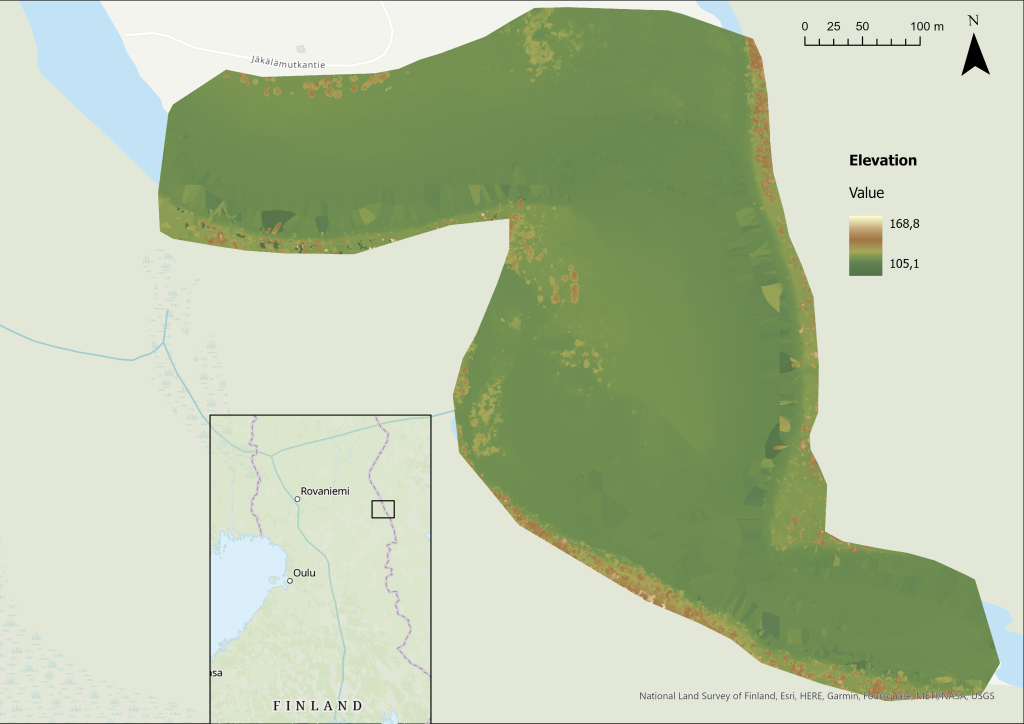
Data and elevation
This dataset was created with drone using Structure from Motion (Sfm) technique in which drone images from different heights and angles are combined. Data is raw so it is not processed beforehand and that should be noticed when using this data. There might be errors in the data caused by reflection on clouds in the water or the effect of dark water surfaces. The dataset is in TIF format in 1.5cm cell cize. Elevation map of the area can be seen on the left.
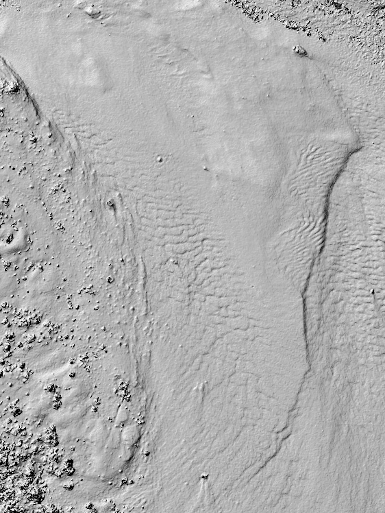
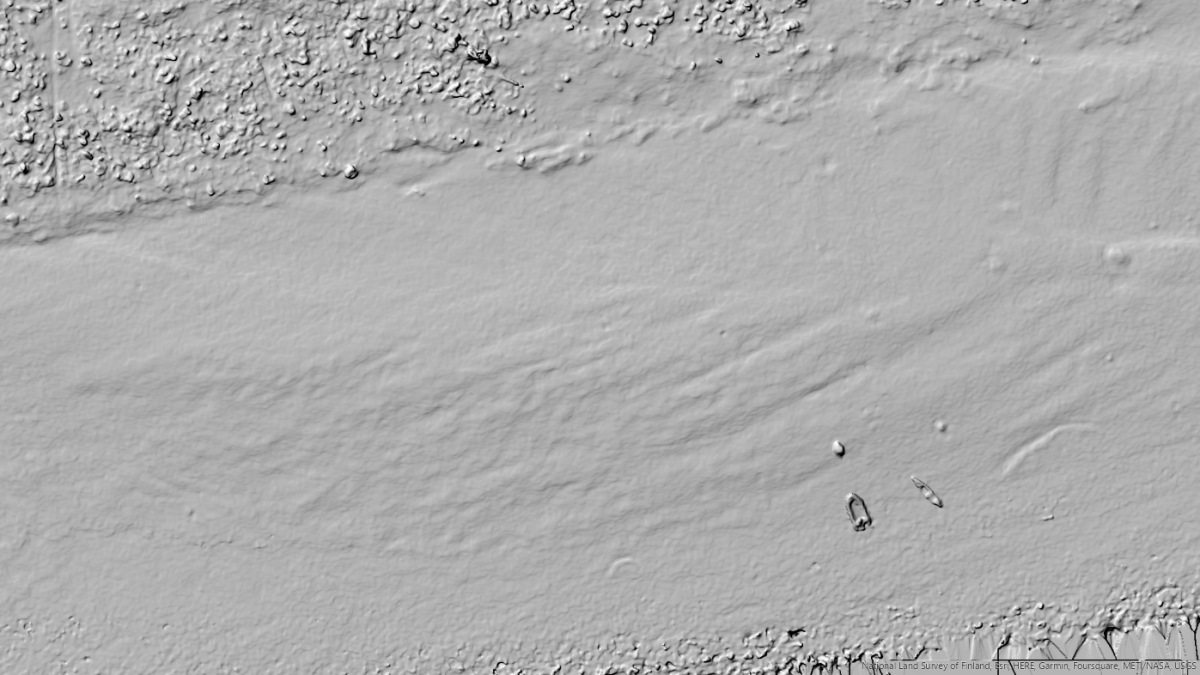
Hillshade
We used hillshade tool to visualize the river environment. Hillshading helps to see the effects of the river flow in the area clearer.
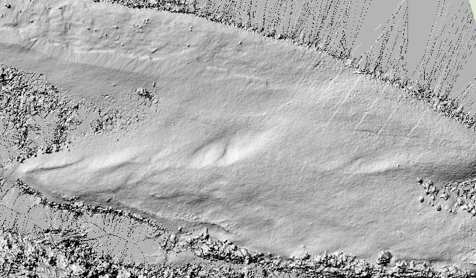
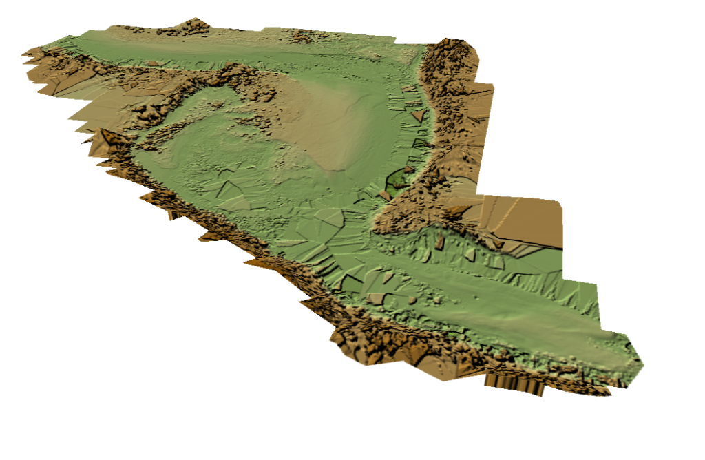
3D visualization
The purpose of this dataset is to study how the flow of the river changes the topography of the river environment. The dataset can be used for making a digital elevation model, digital surface model or digital terrain model of the river environment and it can be compared with elevation models from different years to analyse how the river flow changes the environment. We decided to visualize the dataset three-dimensionally since it includes elevation model. We used the hillshade raster and combined that with satellite images from Esri. Here is an example of the model visualization.
Field experiences
We interviewed one of the data creators, Linnea Blåfield and asked about her field experiences regarding this project. Some of the ideas and experiences are presented below:
Why was this place chosen?
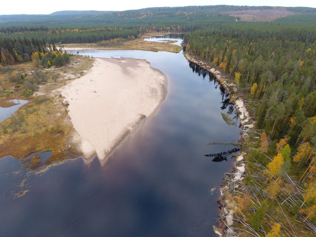
– Oulanka river is one of the fastest migrating meandering rivers in Fennoskandia due to the narrow and confined valley, the bends are moving towards downstream with a speed of 5-8 meters per year. Jäkälämutka bend is like a nature laboratory for researcher to map and this place has been monitored by Oulanka research station and Oulu university researchers since 1974.
Picture: Linnea Blåfield
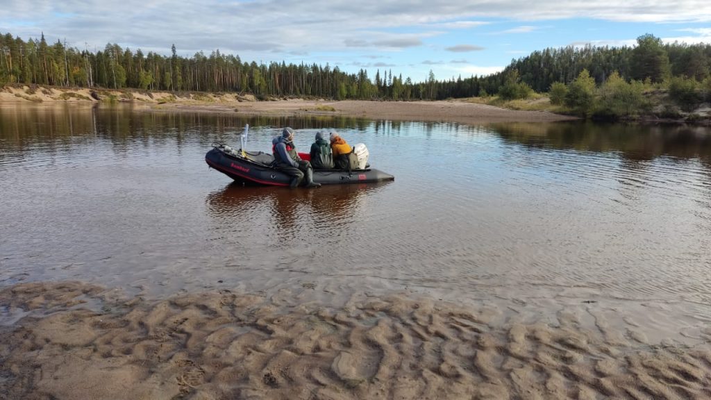
What did the field work consist of?
Long days included for example measuring water level and discharge, measuring underwater geometry, collecting reference points and river sediment and of course flying the drone.
Picture: Linnea Blåfield
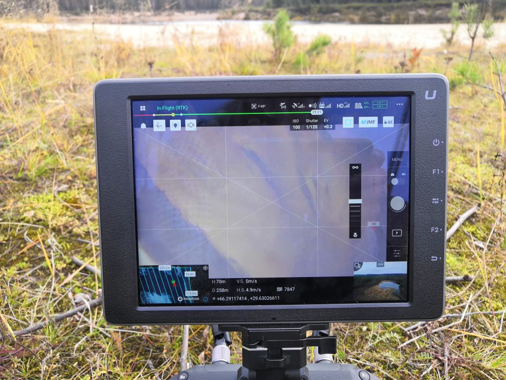
Were there any challenges? What did you enjoy the most?
Perfect weather for drone is when the sky is totally gray, no clouds, sun or rain. This time only challenge was clouds reflecting from the water surface.
The thing I enjoy the most is seeing the data on your screen and see you have collected good data. Also drone data is fascinating because you can see the area from a totally new perspective and even the river bed, dynes and ripples through the water.
Picture: Linnea Blåfield
Drone video from the river: